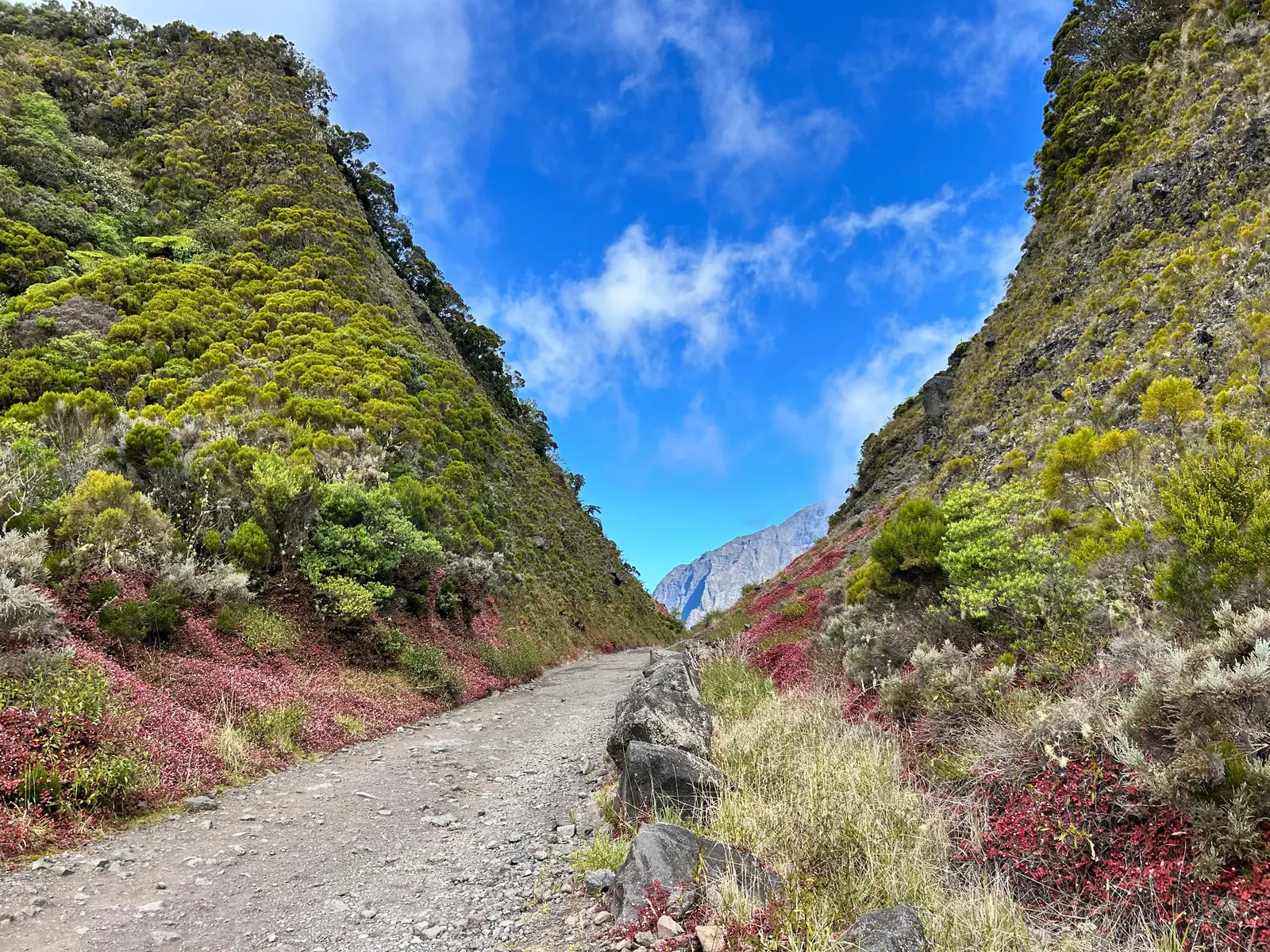
From short walks to waterfalls to multi-day routes through Mafate, Réunion offers hiking for very different levels of experience and fitness.
Updated: 19 October 2026
By Frank Knabe · personal experience on Réunion Island
Something for almost every level
From short walks to waterfalls to demanding mountain hikes, La Réunion has trails for a wide range of abilities. We have enjoyed many outings with our children. Trails are often well signposted, and even a short walk can lead to impressive natural sights.
We also regularly meet older hikers enjoying gentle day walks or even setting off on multi-day trips. The key is to choose a route that suits your fitness: steep climbs and repeated descents can make even a short hike demanding.
From the volcano to hiking holidays across the island
What we particularly love about hiking on La Réunion is the changing scenery: tree ferns and tropical forests, waterfalls and deep gorges, sweeping views and the stark volcanic landscapes of Piton de la Fournaise. Sometimes the surroundings change completely within just a few kilometres.
If you want to spend several days on the trail, you can walk between villages and through the island’s cirques. We have completed a four-day hike through Mafate ourselves, staying in gîtes, simple accommodation offering dinner and breakfast when booked in advance. What stays with us most is the quiet: no roads or car traffic, just steep mountainsides, small settlements and nature all around.
Our hikes on La Réunion
We have walked and filmed each of the following hikes ourselves. Here you will find our personal experiences and the video for each outing.
Where available, distances come from our recordings or from the route descriptions and information boards explicitly mentioned. Our observations describe the day of each hike; trail conditions and access may have changed since then.
From Maïdo to Grand Bénare: 17 kilometres and a change in the weather
Starting at the Maïdo car park, at around 2,200 metres above sea level, we climb towards Grand Bénare at 2,898 metres. Our recorded route covers approximately 17 kilometres in total. The trail initially seems surprisingly manageable, but the ascent continues for hours.
Along the way, we enjoy wide views and watch paragliders above Grand Bénare. We also clean our shoes at a biosecurity station, designed to help prevent hikers from carrying seeds of invasive plants into sensitive natural habitats.
Shortly before we arrive, the weather changes. The summit is covered in mist, and rain follows on the descent. Alongside the scenery and physical effort, a memorable moment of people helping one another stays with us.
Piton de la Fournaise: a night in the Plaine des Sables
For us, this outing starts the evening before the hike. We spend the night at around 2,100 metres in the Plaine des Sables, surrounded by striking volcanic scenery. The following morning, we set out to hike on Piton de la Fournaise.
Eight months after arriving on La Réunion, we return to a place that fascinated us on our first visit. The stark landscape, the overnight stay at altitude and the next day’s walk make this a particularly memorable trip.
Plaine d’Affouches: four hours of hiking before work
Janick and I head to the Plaine d’Affouches in northern La Réunion. Our approximately 14-kilometre hike follows the Ravine Saint-Denis through dense forest, reaching an altitude of around 1,150 metres. The steep sections leave me breathless, while Janick, “the machine”, seems to keep going effortlessly.
Between tree ferns, palms and picnic areas, openings in the forest reveal views towards the coast, including Le Port and La Possession. During our visit, the effects of Cyclone Garance are still clearly visible: landslides, collapsed sections and connections that were closed at the time have left their mark on parts of the landscape.
We return after 4 hours and 10 minutes. I then head back to my desk to work. I even manage a short video call along the way: on that particular day, the mobile connection works very well there.
Grande Chaloupe and the Chemin des Anglais: 20 kilometres with Janick
On this approximately 20-kilometre hike, Janick and I reach Grande Chaloupe. We pass the historic Lazaret quarantine site, discover traces of La Réunion’s former railway and eventually head back towards La Montagne along the Chemin des Anglais.
For me, the outing also becomes a physical challenge. Our first heart-rate comparison says it all: Janick is at 83, while I am at 160. Later, he waits patiently for me and even has enough energy left to jog during the final kilometres.
The hike combines scenery, island history and our own particular way of spending time on the trail together.
To the Dolomieu crater: a night-time drive from Saint-Pierre
We leave Saint-Pierre by car in the middle of the night and head towards Piton de la Fournaise. Our hike starts at the Pas de Bellecombe-Jacob car park. We first descend into the Enclos Fouqué, pass the small Formica Léo cone and cross the volcanic landscape before climbing towards the Dolomieu crater viewpoint.
Along the way, we can see as far as the sea. Just as we think we have earned a proper rest, we realise that our actual destination is still further ahead. The extra walk is worthwhile, but it also adds to the return journey.
The viewpoint stands at around 2,480 metres above sea level. Official descriptions put the standard route at approximately twelve to thirteen kilometres out and back. On our visit, we are out from 6:20 a.m. until around 12:45 p.m. The descents are particularly hard on my knees, and the final stretch involves climbing out of the Enclos to return to the car park.
Pic Adam: a loop through tree ferns and cryptomeria forest
Starting in Bois de Nèfles above Saint-Denis, Janick and I follow the Boucle du Pic Adam. The information board describes a 7.5-kilometre loop with approximately 500 metres of ascent and the same amount of descent. Its suggested walking time is 2 hours and 45 minutes, excluding breaks, and it is rated moderate.
After a longer break from hiking, I find the climb more demanding than expected. The varied scenery makes up for it: mist drifts across the hills, views occasionally open towards Sainte-Marie and we discover a small waterfall along the way.
I am particularly taken with the tree ferns and dense stands of cryptomeria. Some sections feel like a setting from Jurassic Park. The shifts between open views, mist and lush vegetation are what make this hike special for us.
Bélouve and Bébour: a forest walk during our annual fast
During a weekend in January 2025, Sylvia and I explore the forests of Bélouve and Bébour. We are already on the eleventh or twelfth day of our annual fast and intend to keep our walks short.
At the Gîte de Bélouve, we take our bearings from the signposted route towards the Col de Bébour through the two forests. We are impressed by the maintained paths, tall trees and tamarins. Along the way, we also enjoy a view of a waterfall dropping into a deep, green gorge before mist moves in.
The repeated climbs and descents take much more effort than I expected that day. What we imagined as a gentle outing also becomes a personal reminder of how different a hike can feel depending on our energy levels.